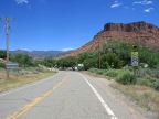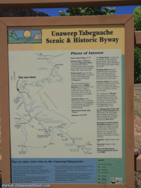
Unaweep Tabeguache Scenic & Historic Byway
Places of Interest
East Creek bridge
Cactus Park
The ancient Gunnison River
carved the sheer walls of
Unaweep Canyon before diverted
by the uplift of the Uncompahgre
Plateau 300 million years ago.
Divide Road travels over the
Uncompahgre Plateau, a massive
landform stretching between
eastern Utah and Ridgeway.
With a commanding view of
Unaweep Canyon, Driggs
Mansion has succumbed to the
ravages of time. Driggs, a
wealthy New Yorker, built the
house from 1914 to 1918, but
some old-timers say his family
never lived there.
Unaweep Seep, a wet
meadow also known as Swamp
Hill, supports a thriving population
of birds, animals, and butterflies,
including the rare Nokomis
Fritillary butterfly.
West Creek Picnic Site
Gateway
The Niche Road, a rough road
that requires a high clearance
vehicle, travels to the Gateway
Mining District, where abandoned
mines remain from earlier mining
activity.
Hanging Flume was built
suspended above the Dolores
River to transport water to a
placed mine on Mesa Creek.
Remnants of the wooden flume
still cling to the canyon walls.
Paradox Valley is so named
because the Dolores River travels
across the valley rather than
down it. The valley is bordered by
a maze of sandstone canyons
and monoliths.
The mining town of Uravan
was named for two minerals
processed there: uranium and
vanadium. The entire town and
mill, except for the boarding
houses and community center,
has disappeared due to
reclamation efforts.
The Tabeguache Creek and
Specie Creek Preserves are
sanctuaries of the San Miguel
River, privately owned by The
Nature Conservancy. Fishing in
these preserves is catch-and-
release only.
Dominguez and Escalante
Expedition Camp marks the
campsite of two Spanish priests
and their party. They were here
August 21 & 22, 1776, while
trying to find a passage from
Santa Fe, New Mexico to the
missions of Monterrey in northern
California.
Naturita. Lodging, dining, visitor
info.
Norwood Lodging, dining,
visitor info.
Norwood Hill, Beaver
Creek, and Specie Creek
Tips to enjoy your trip on the Unaweep Tabeguache:
Allow 3 hours to drive the byway one way, between
Whitewater and Placerville, not including stops.
Highways 141 and 145 are suitable for all vehicles. Please
use caution on unpaved side roads as they are slippery when
wet. Four-wheel drive only roads are marked on the
accompanying map.
Always start with a full tank of gas and plenty of water and
food. Gas, food, and lodging are available in Naturita,
Norwood, and the nearby communities of Grand Junction,
Delta, Montrose, and Telluride.
Stay on existing travel routes as driving and walking off roads
and trails destroys vegetation and causes erosion.
Never touch, remove or deface rock art or fossils, it is a crime
punishable by law.
Respect private property. Some sites are on private property
and inaccessible to the public. Pick up a detailed land
ownership map at the Division of Wildlife, Bureau of Land
Management, or U.S. Forest Service in Grand Junction,
Montrose, Norwood, or Telluride.