Entry Points:

About San Miguel County
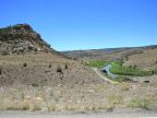
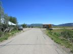
San Miguel County lies in a country of mountains and steep-sided canyons in western Colorado. It is named after the San Miguel River which flows out of the 13,000-foot peaks of the Rocky Mountains near the eastern border. The Dolores River also flows through the western edge of the county, and both have cut deep canyons. Mining communities such as Telluride (the county seat), Placerville and Ophir sprung up in mountains on the east side, which had a boom day and have since declined in population and are reinventing themselves as tourist destinations. A narrow agricultural region exists along the western border, where Egnar is located. Disappointment Valley, a large desert basin fills the center of the county.
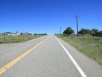
The name San Miguel is Spanish for Saint Michael. It was divided out of Ouray County on February 27, 1883. The population was 6,594 in the year 2000. State Highways 141 and 145 pass through the county, the former on the west side and the latter on the east side. Both take a winding route dictated by canyons, gorges and mountains.
For More Information:
San Miguel County has an official site at www.SanMiguelCounty.org and Wikipedia has a brief San Miguel County article.