Entry Points:

About Dolores County
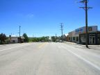
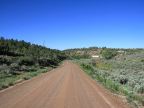
Dolores County was created on February 19, 1881 with an area of 1,068 square miles in the southwestern area of Colorado. Its western border is on the border with Utah and extends eastward from there in a long skinny stripe. It is named for the Dolores River which passes through the county in a deep gorge. The population of the county is very small, 1,844 in the year 2000. Much of the terrain is very rugged, but a farmland area exists in the western portion, around the county seat at Dove Creek.
In ancient times, the region was inhabited by the Ancestral Puebloans who flourished here and had a population that may have exceeded its present-day population. Extensive ruins have been found, some with hundreds of rooms. They disappeared around 1300 AD and nomadic Ute and Navajo Indians wandered through. In 1878, the Ute Indians were removed from the area to reservations and miners moved to explore the area for its mineral resources. The mining district at Rico had a population that reached 5,000 at its peak in 1892. But by 1900 the mining boom had ended and few remained.
The Escalante Expedition of 1776 passed through this area and camped on Dove Creek, and it was also a way station on the Spanish Trail.
Dove Creek was settled around 1910 and became the county’s most stable community, based on agriculture. The town named Dolores is in Montezuma County, rather than Dolores County.
For More Information:
The Dolores County official site is at www.DoloresCounty.org. See also the Wikipedia Dolores County article.